[Name] [ID] [County] [City] [Elevation]

Louisa County/Freeman Field


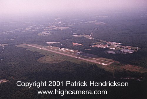
Photo by Patrick J. Hendrickson - http://www.highcamera.com/
Copyright 2001, Patrick J. Hendrickson, All Rights Reserved

Do you have an aerial photo of this airport?

Airport Details
Elevation:493 feet
Latitude:38ø00'36"N
Longitude:77ø58'14"W
Nearest City:Louisa
County:Louisa
Sectional Chart:Washington
Navaids, Frequencies, etc.:AirNav LKU

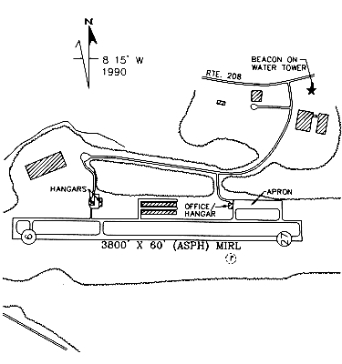
Diagram from the 1998 Virginia Directory

1

Accomodations, Hotels, etc.

Anna Point Inn
(800) 476-0454
Lighthouse Inn
(540) 895-5249
Rebel Motel
(540) 967-1585

Attractions

Lake Anna

Businesses

Corporate Jets, Inc.
(540) 967-3816
Skydive Virginia
(540) 967-3997

Enhance your exposure on Virginia Aviation Online

Unless otherwise specified, all text, html, sql and photographs are Copyright 1994-2008, John S. Huggins.
No part of this site shall be reproduced without the express written permission of the author.
Questions, comments and corrections are VERY welcome! Send them to the webmaster at: john@flyvirginia.com.